- Winter Recap, Mr. Freeze tonight, Rainy chilly roller coaster
- Today Wintry Mix Storm, Big Snow Dawg Barking Thursday??
- Winter Storm #4 and #5, Earth’s Rumbling
- Ice Ice baby verifies, Saddle Up Cowboys and Girls – YEEHAW!! USAID Really?
- Thursday Winter Storm, Pattern is ABSOLUTLETY LOADED – SUPER BOWL STORM
- Clipper Verifies, Vanilla Ice Baby = Thursday Winter Storm
WWA!, Three’s a charm!
Related Articles
National Weather Service New York NY
330 PM EST Wed Feb 10 2021
NJZ004-006-103>108-NYZ072>075-078>081-176>179-111000-
/O.NEW.KOKX.WW.Y.0005.210211T0300Z-210211T1500Z/
Eastern Passaic-Hudson-Western Bergen-Eastern Bergen-
Western Essex-Eastern Essex-Western Union-Eastern Union-
New York (Manhattan)-Bronx-Richmond (Staten Island)-
Kings (Brooklyn)-Northwestern Suffolk-Northeastern Suffolk-
Southwestern Suffolk-Southeastern Suffolk-Northern Queens-
Northern Nassau-Southern Queens-Southern Nassau-
330 PM EST Wed Feb 10 2021
…WINTER WEATHER ADVISORY IN EFFECT FROM 10 PM THIS EVENING TO
10 AM EST THURSDAY…
* WHAT…Snow expected. Total snow accumulations of 2 to 3
inches.
(More than what I am calling for but hey I’ll go with it!)
* WHERE…New York City, Long Island, and most of northeast New
Jersey.
* WHEN…From 10 PM this evening to 10 AM EST Thursday.
* IMPACTS…Plan on slippery road conditions. Hazardous conditions
will likely impact the morning commute.
Three’s a charm!!
Virtual may be in play for all NJ School manana!
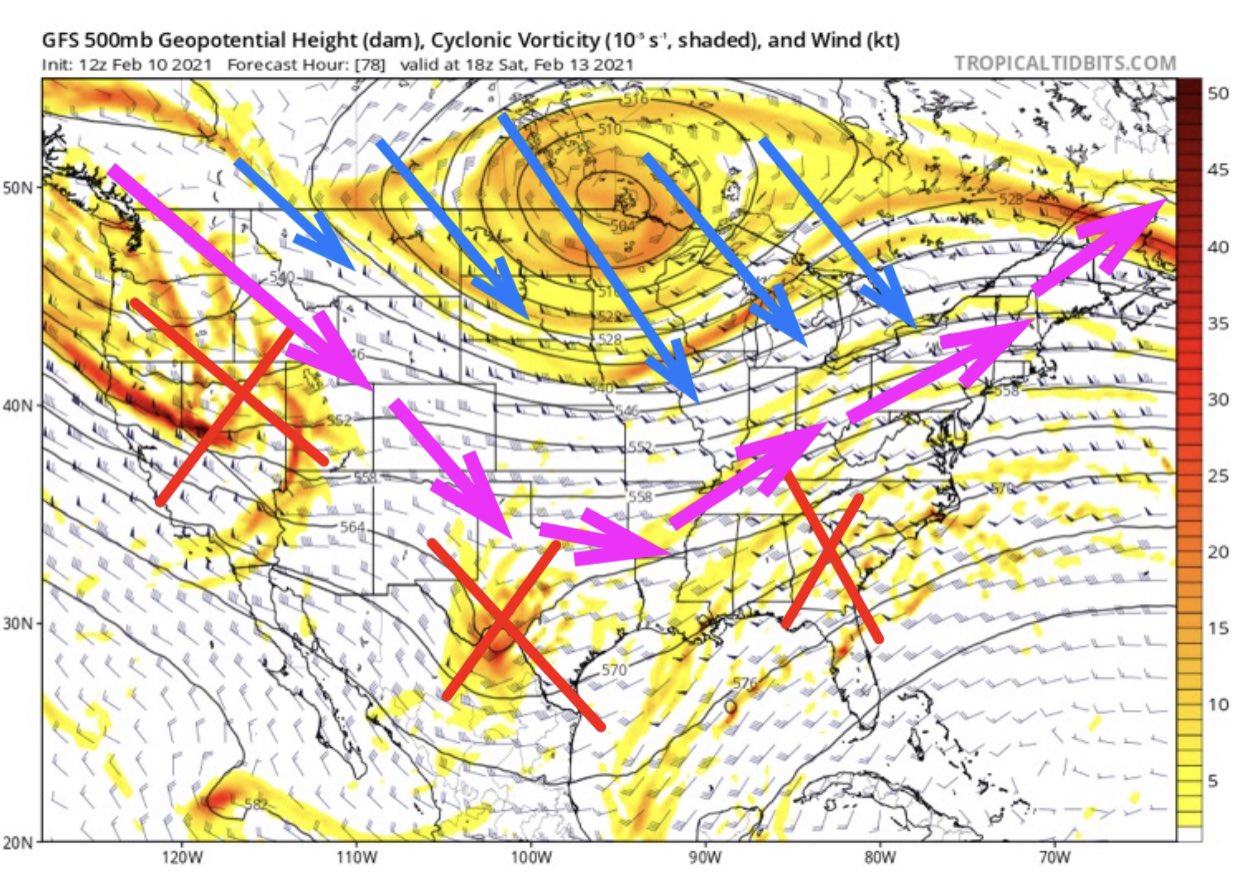
3 storms upcoming – 1st X is tonight next two are Sat Night into Sunday then Tuesday into Wednesday. Each storm will dictate what the next one will do !
X marks the spot – a very active pattern upcoming and beyond!!
From Nsfw Wx


