- Winter Recap, Mr. Freeze tonight, Rainy chilly roller coaster
- Today Wintry Mix Storm, Big Snow Dawg Barking Thursday??
- Winter Storm #4 and #5, Earth’s Rumbling
- Ice Ice baby verifies, Saddle Up Cowboys and Girls – YEEHAW!! USAID Really?
- Thursday Winter Storm, Pattern is ABSOLUTLETY LOADED – SUPER BOWL STORM
- Clipper Verifies, Vanilla Ice Baby = Thursday Winter Storm
IT’S COMING!! RECORDS TO BE SHATTERED
Related Articles

BLUE LINE IS THE RAIN SNOW LINE – CRASHING SE – ABOUT AN HOUR AWAY FROM NE NJ

SARA M GET READY – WOOOP WOOOP
As the low pressure deepens off the East Coast with strengthening cyclonic flow and thus stronger thermal advection, a frontogenetic snow (!!) band is developing NW of Albany, and will pivot through Albany later this evening with light-moderate snow.
Yes, this is May. pic.twitter.com/SvyRQCzPfO
— Tomer Burg (@burgwx) May 9, 2020
PA EARLIER TODAY
Little hard to see but it is coming down good. #PAwx pic.twitter.com/upcRgxGjpG
— Alex Klucher (@AlexKlucherWx) May 8, 2020
NY SAYS ” I CAN TOP THAT”
First time I’ve experienced snow in New York during the month of May! pic.twitter.com/0YKNn8XfFw
— Nicholas Isabella (@NycStormChaser) May 9, 2020
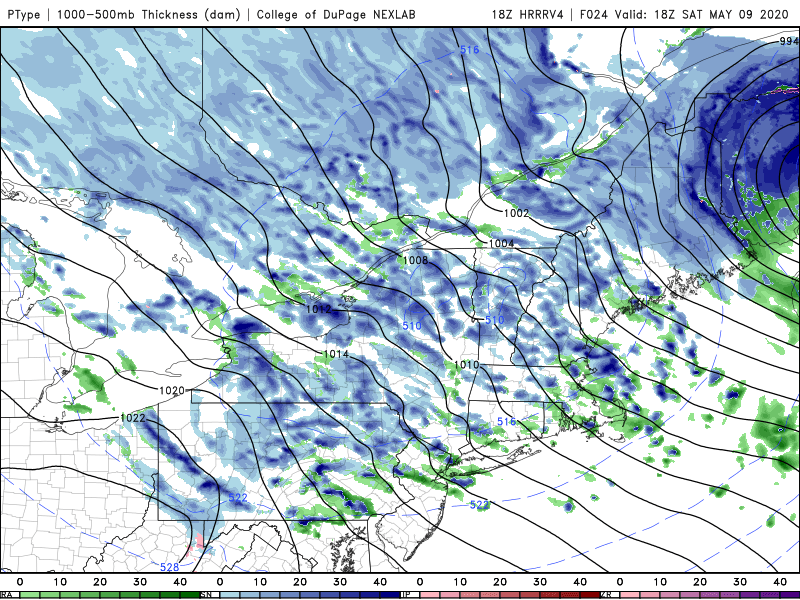
SATURDAY SNOW SQUALLS WILL BE CRAZY AND INTENSE SOME MAY EVEN HAVE THUNDER AND LIGHTENING!!
ALL DAY SATURDAY
SNOW, HAIL AND GRAUPEL
WINDS 20-30 MPH
RECORDS IN 20 STATES GOING TO GET SHATTERED

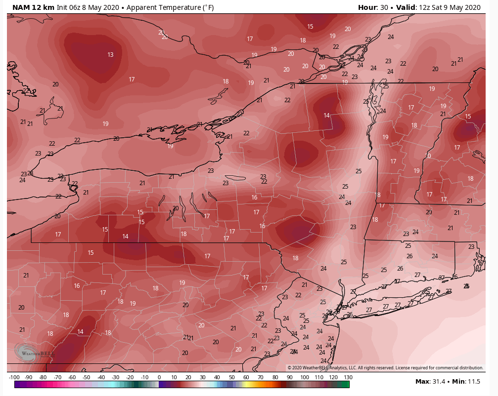
Most locations with long record-books (100-years+) will set record lows Saturday morning with most areas from Great Lakes to Ohio Valley and into upstate New York in the 20s — hard freeze 🌡️.
Light flurries also in the air. ❄️It shouldn’t be snowing on May 9th👀 pic.twitter.com/2SEvBnP8X3
— Ryan Maue (@RyanMaue) May 9, 2020
WIND CHILLS TOMORROW – JESUS H THIS IS NOT MAY BUT JAN OR FEB!!!
UPDATES TO COME.
AL Q


