- Winter Recap, Mr. Freeze tonight, Rainy chilly roller coaster
- Today Wintry Mix Storm, Big Snow Dawg Barking Thursday??
- Winter Storm #4 and #5, Earth’s Rumbling
- Ice Ice baby verifies, Saddle Up Cowboys and Girls – YEEHAW!! USAID Really?
- Thursday Winter Storm, Pattern is ABSOLUTLETY LOADED – SUPER BOWL STORM
- Clipper Verifies, Vanilla Ice Baby = Thursday Winter Storm
Heat Wave 1st of Season, Wet, Fallish like then Eyes on Tropics
Related Articles
A couple more days of this heat wave – th eone nad only basically this entire summer. Thi si my 6th day of 90 degree temperatures since May 1st. I usually have 15 = MUCH BELOW NORMAL. Then it breaks with some westness, well a lot of wetness starting overnight Thursday and lasting thorugh next weekend on and off basically:
Total Wetness ~2″ plus

Here is the wetness on and off with some days being much wetter than others. Green is rain.
Eyes on Tropics
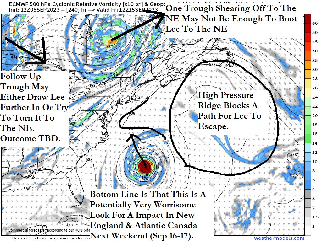
The EURO and GFS took some big steps towards each otehr in the pattern set up for Hurricane Lee which could be affecting the Mid Atlantic through New England possibly next weekend. Effects could be winds and rain with coastal flooding, rough surf and beach erosion are all a possibility. Some minor to moderate overall. We have to see how this progresses. But Lee will become a major hurricane and scoot to th eNorthof the Bahamas. The further South and West he gets means the more we have to watch when and where he makes his turn North.
Nailing the location of Lee as he nears the Bahamas
— DaBuh (@DaDaBuh) September 5, 2023
Interesting to see 12z HAFS going pretty far west. Note mid level ridge to the north pic.twitter.com/gYfAU2wO0G
— StormchaserJS (@stormchaserjs) September 5, 2023
From Rob Lighttown on X9aka Twitter)
For ENTERTAINMENT PIURPOSES: IF THIS WERE TO HAPPEN KISS THE SHORE GOODBYE
The Korean model just showed Hurricane Lee pulling a 1938 redux!!! New England better pray this model is as unreliable as most people think!😲😲😲 pic.twitter.com/HsuYWvvkdG
— Matthew Gross (@HurricaneAddict) September 5, 2023
This guy is nuts!!
How do you know your friend is next level drunk? This… pic.twitter.com/OyTPtNIT2y
— Mike Stanislaw (@mikestanislaw) September 5, 2023
Updates to come and keep the faith in God Almighty!!


