- Winter Recap, Mr. Freeze tonight, Rainy chilly roller coaster
- Today Wintry Mix Storm, Big Snow Dawg Barking Thursday??
- Winter Storm #4 and #5, Earth’s Rumbling
- Ice Ice baby verifies, Saddle Up Cowboys and Girls – YEEHAW!! USAID Really?
- Thursday Winter Storm, Pattern is ABSOLUTLETY LOADED – SUPER BOWL STORM
- Clipper Verifies, Vanilla Ice Baby = Thursday Winter Storm
FIRST EVER VIDEO -LAURA GONNA BE BAD, LEFTOVERS??
Related Articles
It took me a bit of time but I finally was able to produce this 6 minute first ever video. Needs some work as we move forward but the first step is always teh hardest and I will tweak my game and performance as time moves on and I get better with this. No more spelling errors LOL!!!! I am sure Guerci, Carol and Rich, Mike Mugs and teh rest of the peeps will be happy. It’s my typing skills that are not up to par.
My You Tube CHANNEL ADDRESS: https://www.youtube.com/watch?v=Ob9oobzX_5I&t=1s
LAURA GONNA BE BAD!!!
This is LAURA
Look at that swirls she is intensifying and will be a MAJOR HCANE – she is the 1st of 3 or 4 to hit the US this season is the call
Here’s the last we’ll see of #Laura via satellite tonight. You can see the darkness of night creep in at the end of this loop. Despite that the storm will continue to grow in intensity as it makes its way to the Texas/Louisiana border. @weatherchannel is live 🌀 #HurricaneLaura pic.twitter.com/vZCEgDODzn
— Justin Michaels (@JMichaelsNews) August 26, 2020
#HurricaneLaura is taking on a mean look, for lack of a technical storm heading towards diurnal max tonight.
-Robust CDO
-Multiple hot towers present, symmetrically cloaking the COC
-Well defined transverse banding embedded in the storm’s outflow, particularly on the S channel pic.twitter.com/EXCMkidJyM— Mike Mostwill (@MikeMostwill) August 26, 2020
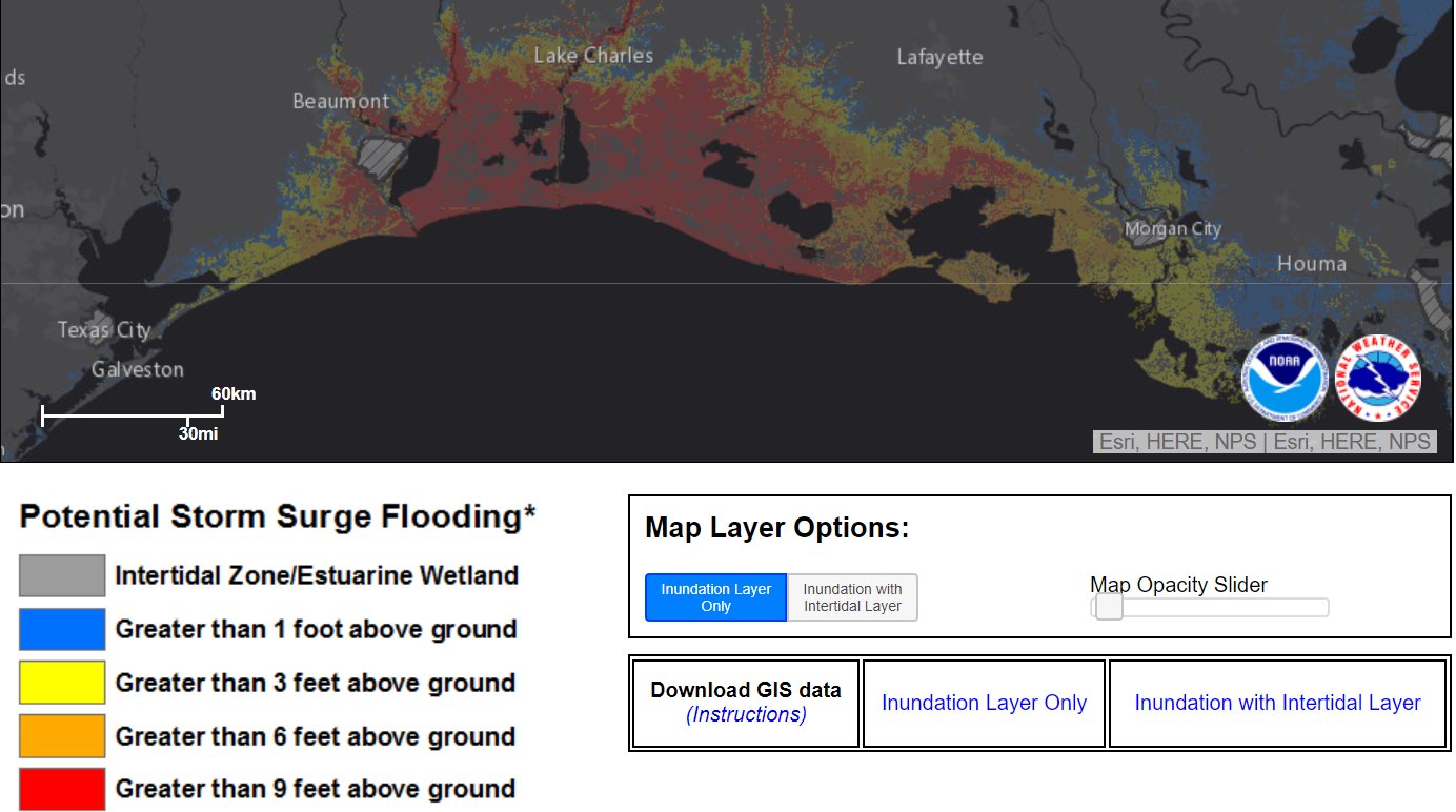
STORM SURGE I WAS TALKING ABOUT IN VIDEO WOWZA!
New CONE/Projected Path of Laura

Remnants for us Saturday nigh into Sunday

EURO makes here a decent tropical storm once off the Delmarva coast – yikes for the coast …again!

Updates to come peeps and hope you enjoyed the video. Please provide comments.
Have a great night and be safe.
AL Q


